The heat wave that started about a month ago will extend and the unseasonable “summer” weather – with temperatures averaging 3 to 4 degrees above normal for the season – will last until the end of next week, with Epiphany expected to be sunny.
“It seems that with short breaks of mild bad weather next week – the first 3 to 4 days of next week – and without significant phenomena, related to a large drop in temperature or snowfall, this ‘summer’ will continue until the end of next week. We cannot predict with certainty more than two weeks into the future. On Epiphany we will have very good weather, with sunshine – except for the morning fogs – and relatively high temperatures for the season” said Professor of Meteorology and Climatology and vice-rector of Economics of University of Thessaloniki, Charalambos Feidas, to state news agencyAPE-MPE.
He explained that this weather phenomenon that “is observed throughout southern Europe and the Mediterranean and not only in Greece and its characteristic is its long duration, which exceeds 30 days and this classifies it in a category of climate instability and not just of a simple weather instability, a warm invasion of a few days”.
Regarding the interpretation of the phenomenon, Mr. Feidas clarified that “it seems to be due – in meteorological terms – to the displacement of the polar jet stream to the north” and added: “The polar jet stream determines the course of the weather systems over Greece and its shift to the north also implies the absence of bad weather systems over our region”.
Regarding the possibility of the good weather being extended beyond the next two weeks, the professor replied that “we do not think that we will spend the next winter months without having the feeling of winter and when the climate instability comes to a recession we expect cold invasions and snow in the area, otherwise it will be a unique phenomenon if it continues throughout the winter.”
The relationship of the warm intrusion in Greece to US polar temperatures
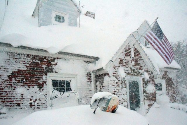
The phenomenon of high temperatures in southern Europe seems to be related to the polar temperatures recorded in the same period in the USA.
“If we combine the two extreme weather conditions, the prolonged high temperatures in Europe and the unprecedentedly low temperatures in the USA, the two phenomena are related to each other”, pointed out Mr. Feidas and explained that “they work like a form of ripple”, as “the very strong cold intrusion pushes warmer air masses from Africa towards Europe”.
Asked if the phenomena are manifested as a consequence of climate change, he replied that “the combination of the two phenomena is indicative of the instability of the climate that we have been experiencing for several years and which is strengthening year by year”, but “a key criterion to connect extreme phenomena of this kind with climate change is the increase in their frequency of occurrence”, so “the more we observe such phenomena, the more they are related to climate change”.
Concern about drought
Regarding the effects of the phenomenon, he observed that “on the one hand, there is the positive aspect of reduced energy demand, but on the other hand, it creates the background for a drought in the coming year, as the largest water reserves come from the snowfalls”.
“During the Spring, when the snow cover disappears due to high temperatures, the water reserve is strengthened. If there is no snow, we will have a deficit in the water balance”, he noted and concluded: “Such a long period of warm invasion, lasting more than 30 days, has not been observed in recent decades. For more than 4-5 weeks the temperature has been on average 3 to 4 degrees above normal for the season and without snowfall. The snow cover in the territory does not even reach 1%, while in such a season it would be over 10%”
Latest News

German Ambassador to Greece Talks Ukraine, Rise of Far Right & Tariffs at Delphi Economic Forum X
Commenting on the political developments in his country, the German Ambassador stressed that it was clear the rapid formation of a new government was imperative, as the expectations across Europe showed.

Athens to Return Confiscated License Plates Ahead of Easter Holiday
Cases involving court orders will also be excluded from this measure.

Servicers: How More Properties Could Enter the Greek Market
Buying or renting a home is out of reach for many in Greece. Servicers propose faster processes and incentives to boost property supply and ease the housing crisis.

Greek Easter 2025: Price Hikes on Lamb, Eggs & Sweets
According to the Greek Consumers’ Institute, hosting an Easter dinner for eight now costs approximately €361.95 — an increase of €11 compared to 2024.

FM Gerapetritis Calls for Unified EU Response to Global Crises at EU Council
"Europe is navigating through unprecedented crises — wars, humanitarian disasters, climate emergencies," he stated.

Holy Week Store Hours in Greece
Retail stores across Greece are now operating on extended holiday hours for Holy Week, following their Sunday opening on April 13. The move aims to accommodate consumers ahead of Easter, but merchants remain cautious amid sluggish market activity.

Green Getaway Ideas for Easter 2025 in Greece
Celebrate Easter 2025 in Greece the sustainable way with eco-farms, car-free islands, and family-friendly getaways rooted in nature and tradition.

Civil Protection Minister Details Summer Firefighting Plans at Delphi Forum
At the 10th Delphi Economic Forum, Minister of Climate Crisis and Civil Protection Yiannis Kefalogiannis discussed Greece's plans for the upcoming fire season.

How Shops and Markets Will Operate During Easter Holy Week
The Easter holiday schedule has been in effect since April 10, with retail stores open Palm Sunday, and most supermarkets also operating to meet consumer demand for Easter shopping

Why Is the French Aircraft Carrier Charles De Gaulle in Piraeus?
Docking in Piraeus after a four-month deployment in the Indo-Pacific region, the admiral of the aircraft carrier the Charles de Gaulle says, "Greece is our best partner in the Mediterranean."


 Αριθμός Πιστοποίησης